Durban International Airport (DUR)
Orientation and Maps
(Durban, South Africa)
THIS AIRPORT CLOSED IN APRIL 2010
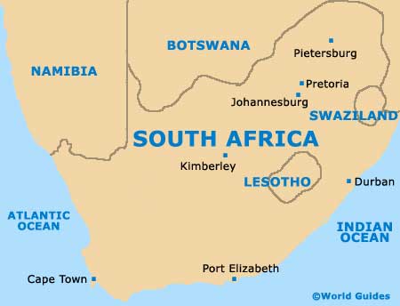
The city of Durban lies on South Africa's eastern coast in the KwaZulu-Natal region. With a population of around 3.2 million, Durban is the third-biggest city in the country and a features a major port. However, Durban is also known for its thriving tourism industry, attracting thousands of holiday makers each year.
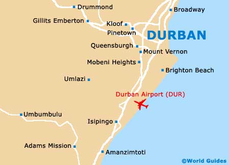
Those flying into KwaZulu-Natal will probably be arriving at Durban International Airport (DUR), which lies just a short distance to the south. Other areas of interest close to Durban include Tongaat, Verulam and Mount Edgecombe to the north, Queensburgh to the west, and Brighton Beach to the south. Also nearby, Pietermaritzburg is the capital of the province and lies to the north-west.
Durban International Airport (DUR) Maps: Important City Districts
Located alongside the Durban beachfront, Marine Parade is the main focal point of this area. Lining the parade are many popular restaurants, together with a number of notable entertainment venues around the interconnecting streets.
An important city thoroughfare, West Street starts its life as a mall and runs in a westerly direction, through the city centre, with the city hall located off this busy road. Durban's main Indian community can be found to the west of the centre, around both Grey Street and Victoria Street.
On the northern side of Durban, the Umgeni River marks the edge of this area, being surrounded by a number of suburban districts. Further suburbs and townships are located all around the city, with the Pinetown area being especially noteworthy and sited on the western side.
Africa Map

South Africa Map
Durban Map